Nature & outdoor experiencesKarura ForestExplore forest trails, waterfalls and nature walks.View Attraction
A practical guide to understanding and moving around Kenya's capital. Find out how to get from the airports, choose the right transport, navigate Nairobi traffic, use public transport and plan your time across the city with greater confidence.
Nairobi is a large, fast-growing city. Its neighbourhoods spread across a wide area, and the time needed to travel between them can change considerably depending on the hour, route, weather and road conditions. A journey that looks short on a map may take much longer during busy periods.
The good news is that Nairobi is manageable once you understand how it moves. Visitors can choose from ride-hailing services, taxis, private transfers, matatus, buses, commuter trains and walking in selected areas. The best option depends on your destination, luggage, budget, time of day and familiarity with the city.
Nairobi's central business district (CBD) is the main commercial and administrative centre. Around it are established residential, business and entertainment districts, each with its own character and road connections.
The CBD is home to offices, government buildings, markets, hotels, shops and major city landmarks. Upper Hill is an important business and healthcare district just south-west of the centre.
Popular for hotels, restaurants, shopping centres, offices and nightlife. Waiyaki Way and Ring Road Parklands are important connections in this area.
Kilimani and Lavington combine residential areas, restaurants and accommodation. Karen is farther out and is known for nature attractions, shopping and suburban stays.
This area includes diplomatic missions, international organisations, hotels, residences and shopping destinations. Travel times to the CBD vary with traffic.
Other important areas include South C, South B, Lang'ata, Embakasi, Kasarani, Thika Road, Ruaka and the wider eastern and northern suburbs. When booking accommodation or transport, check the exact location rather than relying only on the neighbourhood name.
Jomo Kenyatta International Airport is Nairobi's main international gateway. It is located south-east of the city centre, off Mombasa Road, and handles most international arrivals as well as a number of domestic services.
Wilson Airport is a separate airport closer to the central and southern parts of Nairobi. It is widely used for domestic and regional light-aircraft services, including many scheduled safari flights to destinations such as the Maasai Mara, Amboseli and other parks and reserves.
App-based services such as Uber and Bolt are widely used in Nairobi and are practical for door-to-door journeys, airport transfers and trips between neighbourhoods.
Pre-booked transfers are useful for airport arrivals, families, groups, business travellers and guests with several bags. A driver can meet you at an agreed point and take you directly to your destination.
Matatus are privately operated minibuses and are a major part of Nairobi's public transport network. They serve routes across the city and are used daily by residents.
Public service buses operate on a number of Nairobi routes. They can be useful for travellers who know their route and are comfortable using local public transport.
Kenya Railways operates commuter services on selected routes connecting Nairobi with parts of the metropolitan area, including routes towards Ruiru, Syokimau, Embakasi Village, Kikuyu and other served stations.
Motorcycle taxis (boda bodas) and tuk-tuks are available in parts of Nairobi and can be useful for short journeys where road traffic is heavy.
Walking is practical in selected parts of Nairobi, particularly for short journeys within busy commercial and residential districts. The CBD can be explored on foot during the day, and guided walks are a good way to understand its landmarks, history, markets and street life.
Nairobi is not uniformly pedestrian-friendly. Use marked crossings where available, remain alert around traffic and ask locally about the safest route. For a structured introduction to the city centre, consider a private Nairobi City Walking Tour.
Driving gives flexibility, especially for longer stays and trips beyond the city, but visitors may find Nairobi traffic, parking and road behaviour challenging. If you are unfamiliar with the road network or only staying for a short visit, using a driver or ride-hailing service may be more convenient than hiring a car.
In Kenya, vehicles drive on the left. Carry your valid driving documents, follow posted speed limits, wear seat belts and avoid using a phone while driving. Do not assume that a route shown by a navigation app will be free of closures, diversions or congestion.
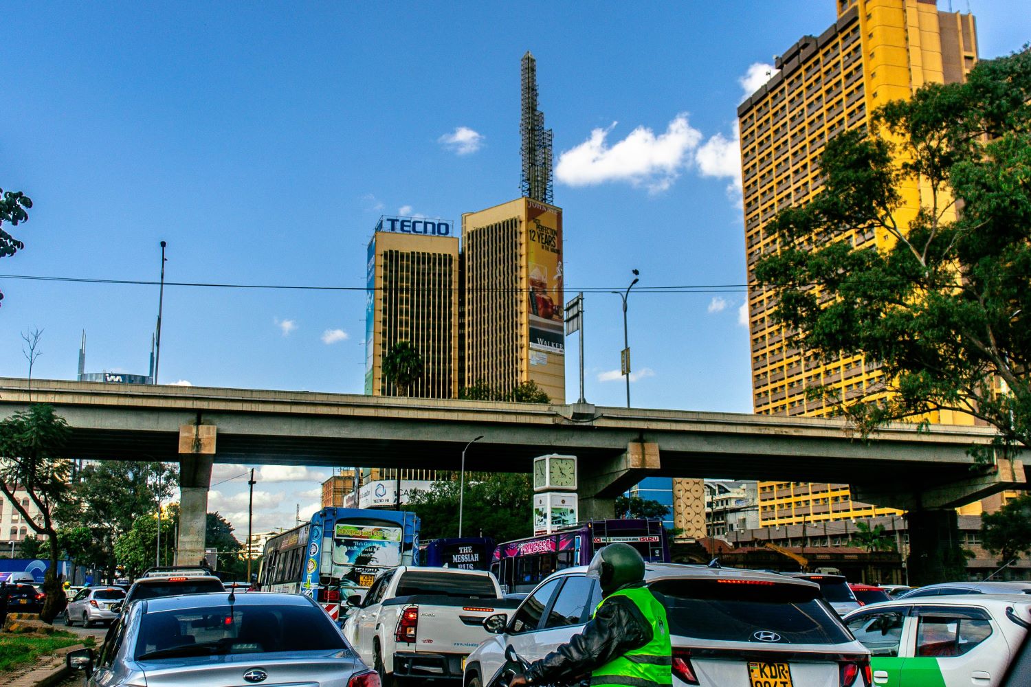
The Nairobi Expressway is a tolled elevated road running between the Mlolongo area and Westlands, broadly following the Mombasa Road, Uhuru Highway and Waiyaki Way corridor. It can reduce journey times on suitable trips, particularly between the airport corridor and parts of the city, but it does not eliminate congestion on connecting surface roads.
| Road / Corridor | Useful for | Visitor context |
|---|---|---|
| Mombasa Road | JKIA, industrial areas and south-east Nairobi | A key airport route; congestion can build during commuter peaks. |
| Uhuru Highway | CBD, Westlands connections and the city centre | Central corridor with busy junctions and major interchanges. |
| Waiyaki Way | Westlands and western suburbs | Important westbound route; traffic varies significantly by time. |
| Thika Road / A2 | Kasarani, Ruiru and northern growth areas | Major multi-lane corridor with busy interchanges and service roads. |
| Ngong Road | Kilimani, Ngong and south-western areas | Useful for several residential and commercial districts. |
| Lang'ata Road | Wilson Airport, Lang'ata and attractions to the south-west | Important for access to several visitor attractions and residential areas. |
| Outer Ring Road | Eastern and northern parts of the city | Connects several busy suburbs and industrial/commercial areas. |
| Northern Bypass / Southern Bypass | Cross-city and peripheral connections | Can help avoid parts of the CBD, depending on the origin and destination. |
Traffic is one of the most important factors when planning movement around Nairobi. Congestion changes by direction, weather, incidents, roadworks, school schedules and public events. The same journey can take very different amounts of time on different days.
| Period | Typical conditions | Planning advice |
|---|---|---|
| Early morning | Roads may be quieter before the main commuter flow builds. | Useful for airport departures and early activities, but allow a buffer. |
| Morning peak | Often busiest from around 6:30 am to 9:30 am on major commuter routes. | Avoid tight cross-city appointments and allow extra travel time. |
| Midday | Some routes ease, while commercial centres and key junctions can remain busy. | Check live navigation before leaving. |
| Evening peak | Often busy from around 4:30 pm to 7:30 pm, sometimes later. | Keep dinner and onward plans flexible if travelling across town. |
| Late evening | Many roads become quieter, but conditions vary by area. | Use a trusted driver or ride-hailing service rather than walking unfamiliar routes. |
If you arrive at JKIA and have a separate safari flight departing from Wilson Airport, allow time to clear immigration, collect checked baggage, meet your driver, cross Nairobi by road and check in at Wilson. A short connection is risky, particularly during commuter peaks. Follow the safari airline's check-in deadline and confirm luggage restrictions in advance.
Accessibility varies across Nairobi. Some pavements are uneven or obstructed, pedestrian crossings are not always convenient, and public transport may be crowded. Travellers using wheelchairs or mobility aids should confirm vehicle access, step-free routes and assistance arrangements before booking.
For most first-time visitors, ride-hailing or a pre-arranged private transfer is the easiest option. Matatus, buses and commuter rail can be useful if you know the route and are comfortable using public transport.
Yes. Both services operate in Nairobi. Availability, prices and pickup arrangements vary, so request rides through the app and verify the driver and vehicle details before boarding.
Many residents use matatus every day. Visitors unfamiliar with the routes should ask a trusted local for guidance, confirm the destination before boarding and take normal precautions with personal belongings.
Some areas, including parts of the CBD during the day, can be explored on foot. However, Nairobi is spread out and pedestrian infrastructure varies. Walking is best for short, planned journeys or guided experiences.
Journey times depend on traffic, route, weather and the exact destination. The Expressway may shorten some trips but is tolled and does not remove delays on connecting roads. Check live traffic and allow a generous buffer.
No. They are separate airports. JKIA (NBO) is the main international airport, while Wilson (WIL) serves many domestic and safari flights. Check the airport code on every flight booking.
Do not assume there is a direct airport train service. Nairobi commuter rail operates on selected routes, while the SGR Nairobi–Mombasa service uses the Nairobi Terminus outside the CBD. Check current Kenya Railways routes and schedules before planning a rail journey.
Yes. It is a toll road, and charges depend on vehicle class and entry and exit points. Check the operator's current tariff before travelling.
Many people travel around Nairobi after dark, but visitors should plan carefully. Use a trusted driver or ride-hailing service, confirm your drop-off point and avoid walking unfamiliar or quiet routes late at night.
For a short city visit, ride-hailing or a driver is often more convenient. Car hire may suit longer stays, frequent travel or self-drive itineraries if you are comfortable with local driving conditions.
They are separate airports and the transfer is by road. Allow several hours for immigration, baggage collection, traffic and check-in, and follow the onward airline's check-in requirements. Avoid tight self-connections on separate tickets.
Routes, operating times, fares, tolls and airport arrangements can change. Check current information with the relevant operator before travelling.